Valley of Fire Photo Spots: A Self-Drive Day Trip From Las Vegas
7 min read
Valley of Fire is the day trip locals love and tourists overlook. About an hour northeast of the Strip, it is a Nevada state park full of blazing red Aztec sandstone, slot canyons, and rock formations that look engineered by an artist.
It is a self-drive paradise and a photographer's dream. Here is the route, the spots that actually deliver, and the light timing that separates a great trip from a so-so one.
Getting There and the Basics
From the Strip, take I-15 North about 50 miles to the Valley of Fire exit, then the access road into the park. Total drive is about an hour.
There is a per-vehicle entrance fee, paid at the gate. No timed entry, but it is a state park so bring cash or card for the booth.
Start at the visitor center for the map and current conditions, then work the loop road and the Mouse's Tank Road spur, which holds most of the best stops.
Fire Wave: The Signature Shot
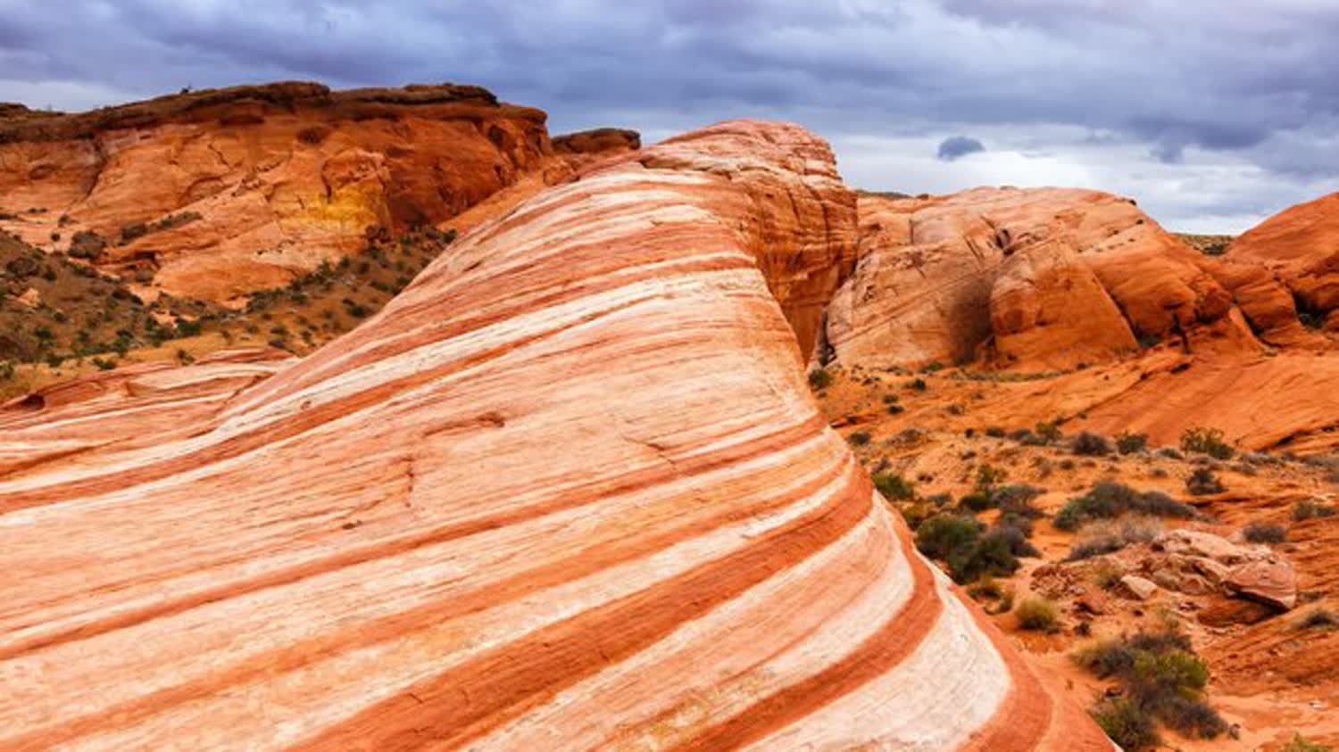
The Fire Wave is the postcard, a striped sandstone formation that looks like a frozen red-and-white wave. It is a short hike, about one and a half miles round trip from the parking area.
Shoot it mid to late afternoon when the low sun saturates the colors, or early morning. Avoid harsh midday light that flattens the stripes.
Note: the Fire Wave trail has been subject to seasonal summer closures due to heat deaths in the park, so check whether it is open and never attempt it in summer afternoon heat.
Mouse's Tank Road and Pink Canyon
Mouse's Tank Road is the most scenic stretch of pavement in the park, with red rock walls rising on both sides. The road itself is a photo.
Pink Canyon, a short walk off this road, is a narrow slot with soft pink and red swirls. It is quick, easy, and incredibly photogenic.
The Mouse's Tank trail itself is a short sandy walk to a natural water basin, with petroglyph panels along the way.
Elephant Rock, Arch Rock, and the Cabins
Elephant Rock, near the east entrance, is a natural arch that genuinely looks like an elephant's trunk. A two-minute walk from the road.
Arch Rock and the Atlatl Rock petroglyphs are quick, high-value stops off the main loop. Atlatl Rock has a staircase up to ancient rock art.
The historic Cabins, built of native sandstone, make a great foreground for the surrounding red rock. Easy, fast, and photogenic.
Timing, Light, and Safety
Go in the cooler months, October through April, or early morning in shoulder season. Summer is genuinely dangerous here, with regular heat-related rescues.
Golden hour, the hour after sunrise and before sunset, is when the sandstone glows and the photos sing. Midday washes everything out.
Carry more water than you think and do not rely on cell service. The park is remote.
This is a self-drive trip through and through. A few tours run out here, but the whole appeal is stopping wherever the light is best, which a tour bus will not let you do.
David X Las Vegas earns a commission on bookings made through this link, at no extra cost to you. It never changes my honest take.
Frequently asked
Is Valley of Fire worth the drive from Las Vegas?
Absolutely. It is the most photogenic spot near Vegas and far less crowded than the Grand Canyon options. An hour each way for the Fire Wave, Mouse's Tank Road, and Pink Canyon is well spent.
When is the best time for photos at Valley of Fire?
Golden hour, just after sunrise or before sunset, when the low sun saturates the red sandstone. Avoid harsh midday light. The cooler months are also far safer.
Can I do Valley of Fire without a car?
It is much harder without one. The park is built for self-drive with stops spread along the loop. Some tours run from the Strip, but you lose the freedom to chase the light.